Water is not the enemy, it is water velocity (speed) that causes the damage. Australian rivers are meant to be rough and bumpy and riparian vegetation can provide protection from flood impacts along with individual and cumulative benefits to landholders up and down stream.
Healthy, intact riparian zones are great for fish, and often the task of restoring our degraded rivers edges places fish managers at odds with land managers. Recent research following the South East Queensland floods of 2013 however, shows that a good riparian zone is not only good for fish, but extremely valuable for farmers.
The Condamine has experienced five large flood events in recent years causing localised and widespread flood damage. The 2013 flood event was so severe that a flood recovery program to aid agricultural recovery was funded by the Queensland and Australian Governments through the natural disaster relief and recovery arrangements. The program aimed to restore productivity and build resilience against future extreme weather events. Greg Ringwood outlines the experiences and findings from the Glengallan and Swan Creeks Ex-cyclone Oswald Flood Recovery Program.
The 2013 Flood
The 2013 flood was due to a major rainfall event that dumped 1000 millimetres of rain in 72 hours across the Glengallen and Swan Creek’s floodplain. This area has experienced flooding on a regular basis, with major flood events on average once every decade. Talking to long term landholders they all said:
“higher floods had occurred in the 1950’s and 1970’s than the 2011 and 2013 flood events. The recent floods were angry, particularly the 2013 flood, they had never heard anything like it, the speed of the water was so fast and the damage was much worse this time”.
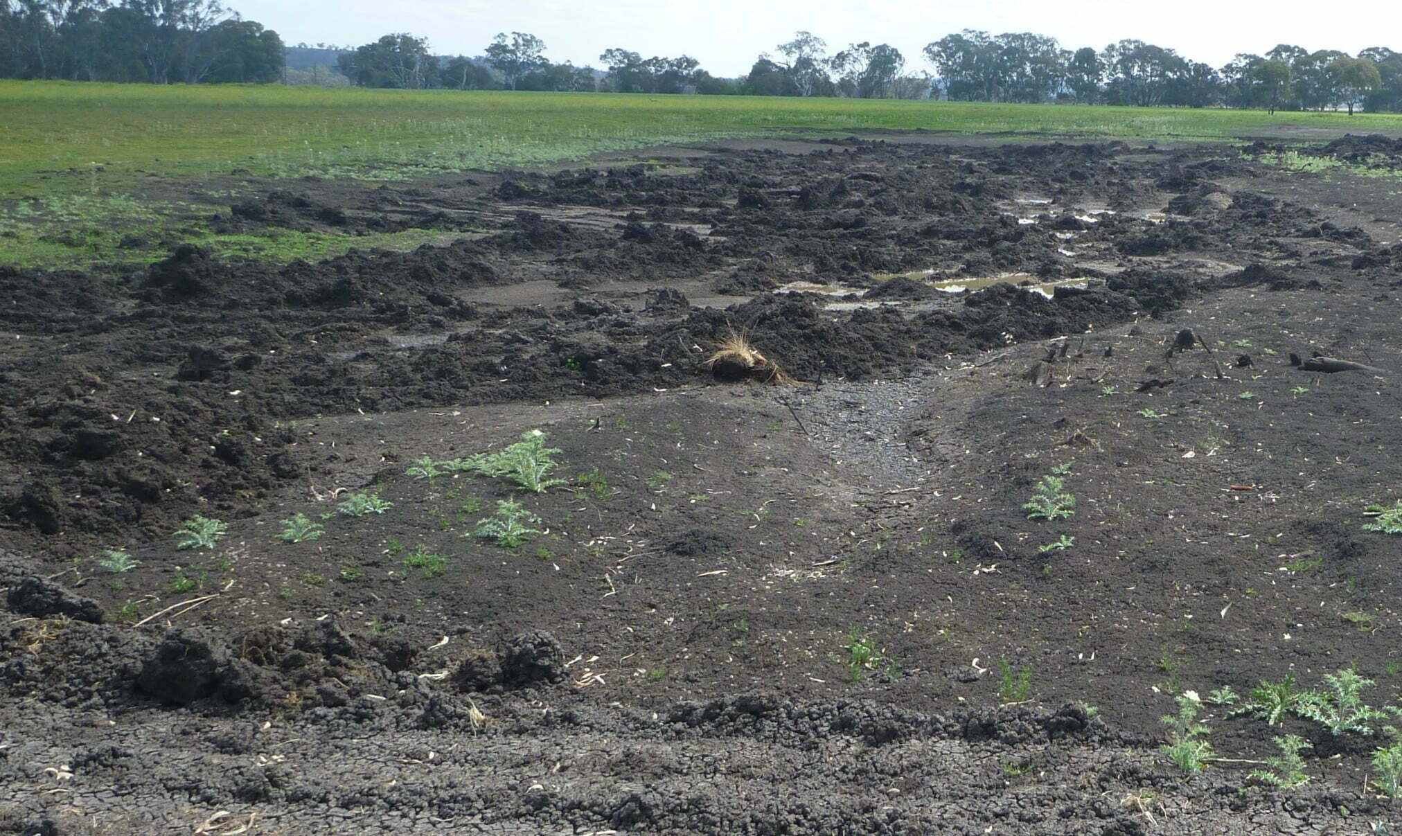
Floodplain scalping erosion, this farmer lost a large amount of land as a result of unprotected riparian banks, photo Greg Ringwood
Lost productivity and estimated damage
The flood damage included extensive erosion along creeks and across the floodplain. It was visually evident that high water velocities had caused erosion. Many landholders lost up to 500 mm of topsoil, and creek bank erosion was extensive along the waterways. Historically, water took 1 day to travel from Killarney to Warwick. Now it takes 12 hours due to land use change and flood mitigation measures. Recent work on soil erosion in the area showed soil erosion starts at 0.4 m.s–² on this soil type and, unfortunately, water velocities were modelled to reach 4 m.s–² in the creeks and 2 m.s–² across the floodplain during the 2013 flood event. As a consequence, erosion damage was high. The Queensland Reconstruction Authority estimated ex-cyclone Oswald caused $2.4 Billion in damages across 90 Queensland towns and 6500 homes, including the Condamine Catchment.
A component of the flood recovery program was to estimate the value of lost productivity and the cost to restore the damage for each property involved in the program. Specialists in soil conservation, agronomy and river restoration were used to assess the flood damage and recommend restoration activities to restore productivity and build reliance against future flood events. This specialist group worked with landholders to estimate productivity losses and damage costs including:
- hectares of crop loss with a value of $ per ha,
- percentage per hectare productivity reduction for up to 5 years
- cost of stored feed and grain lost
- cost value per m–³ soil moved to repair flood damage
- amount of nutrients per ha for x years required to restore soil productivity,
- cost per km of fencing replaced
- cost of debris clean up and
- cost per km of riparian restoration.
The values of lost productivity and damage were estimated and collected in a consistent manner across all sites. Interestingly, there were a number of properties on the floodplain where the estimated cost of damage and lost productivity was much lower than the rest. The common factor these properties had was riparian vegetation in reasonable to good condition. The three floodplain properties with the best riparian vegetation were estimated to have suffered the least damage and lost productivity,with around one third of the damage compared with the average across the whole program ( see Table 1).
This study clearly indicates that good riparian zones are extremely valuable to farmers and that, with their value to fish well-known, maybe it is time for a large scale program to support farmers in restoring their creeks and river frontages. This would be timely, as with more intense flood events predicted due to climate change, current and past waterway and riparian management actions(often for flood mitigation) are costing landholders, primary productivity and regional communities’ money.
A formal economic study to gain a complete robust economic value of individual and cumulative flood damage for various levels of riparian vegetation (flood mitigation management activities) is warranted. In the meantime though, the message is clear, good riparian vegetation makes good environmental and economic sense.
Greg Ringwood prepared this article for the recent RipRap Magazine and you can contact Greg for more information greg@rhhr.com.au or click the image below to read more about RipRap Edition 39 Habitat makes Fish Happen.
