We are honoured to work on the ancestral lands of the Ngunnawal and Ngarigo People and we recognise their continuing connection with, and knowledge about land, waters and community. We pay our respects to them and their cultures; and Elders past, present and emerging.
Adapted from: Welcome to Country & Acknowledgement of Country – Creative Spirits
River Dreaming image (right). Artist: Richie Allen (Ngunnawal/Kamilaroi), Traditional Aboriginal Owners Corporation.


“People must feel that the natural world is important and valuable and beautiful and wonderful and an amazement and a pleasure.”
– Sir David Attenborough
Project Purpose
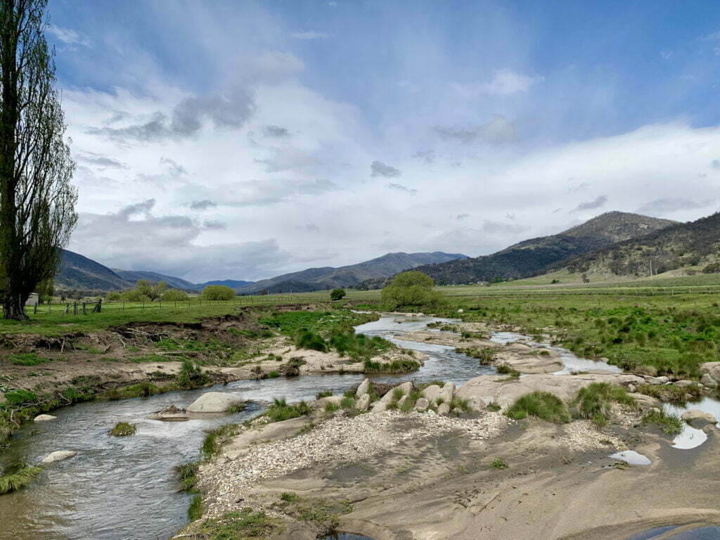
The Naas River project is Rivers of Carbon’s most recent partnership and our first project in the ACT. The goal is to build resilient landscapes that can withstand future stresses from drought and bushfires. This will in turn help improve water quality and the area’s biodiversity. The Naas River is an excellent starting point for these goals because it is contained by the Naas Valley, offering a connected strip of waterfront properties with landholders interested in working together to secure a sustainable future, as well as connecting to the beautiful National Parks that extend around their homes.
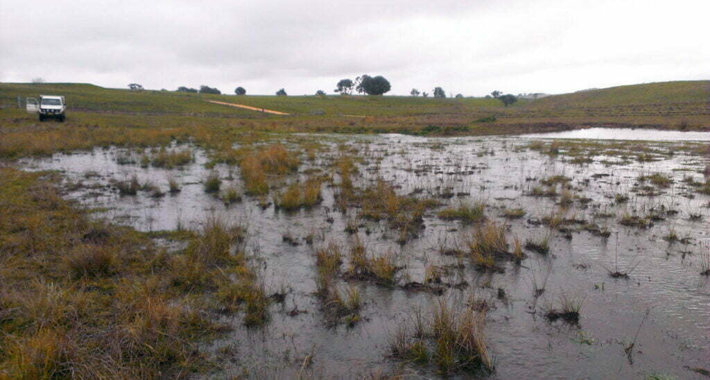
The Naas River is located in the southern end of Namadgi National Park. This perennial stream flows for over 25 kilometers before it joins with the Murrumbidgee River, one of the four major rivers within the Murray Darling Basin catchment. The river’s water quality is of high priority, and it helps supply Canberra’s water. Historically, the land was used for grazing stock, leading to a large mobilisation of sediment washing downstream. While some agriculture continues in the area today, there is a larger emphasis on land for conservation and biodiversity, as the river is connected to national parks. Several species of endangered birds can be seen flying in the valley, including the Scarlet Robin, Flame Robin, Jacky Winter and Wedgetail Eagle. These are well-loved by land holders and visitors alike.


This region has had some conservation attention in the past including a river assessment by a geomorphologist and historian in 2000, who looked at the erosion and sedimentation issues present in the Valley. It was clear that much of the erosion was from channelisation of what was once a swampy meadow, followed by re-erosion of ‘post-settlement alluvium’. Over the years, the channel would constrict in times of drought and be reworked in times of high river flow. The report was entitled ‘Nature of the Naas’ (Starr, 2000) and provided new insight on this stretch of river, but the issues were never addressed with significant resources. If you are interested in reading more about the past and present for the Naas River and Valley, please access the resources below or get in touch with us!
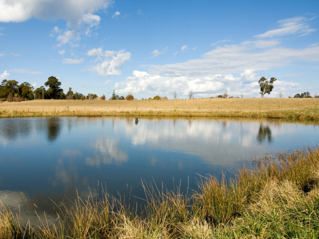
The Naas River was identified as a focus area for Rivers of Carbon for a number of reasons – reducing erosion, improving water quality, stabilising banks and increasing biodiversity. ACT riparian and river systems are already experiencing considerable pressure from a changing climate, such as increased water temperatures, reduced average river flows, flash flooding and an increase in drought effects. Through support provided by the Australian Government’s Future Drought Fund, on-ground works will include fencing, revegetation, installation of alternative stock water where needed, small scale erosion works (to stabilise head cuts), minor woody weed control, and community ‘get-togethers’ to raise awareness of the issues, offer solutions and garner interest in continuing river restoration works into the future.
This project engages the rural landowners who manage 12km’s of agricultural land either side of the river from the Namadgi Park boundary to the confluence of the Gudgendy. With their help, the Naas river and surrounding valley can adapt to the pressures of increasing temperatures and fluctuating water availability. By bringing farmers and project partners together to set and achieve a shared vision for drought resilience through restoring the health and rehydration of the Naas valley ensures the long term commitment of improved river, stock and human health. The Rivers of Carbon team looks forward to working alongside landholders for the benefit of the Naas River and surrounding communities.

Outcomes we are aiming for:
![]()
Protect and restore 23.1 ha of riparian land
![]()
Manage 5kms of waterways
![]()
Involve 5 landholders
![]()
Hold 4 community events
![]()
Manage 8 erosion control remediation sites
![]()
Plant 2,020 native trees and 1,500 native grasses.
![]()
3 km of riparian area protected (fencing)
![]()
Engage 80 local volunteers
Want to get involved?
Terrific, we would be delighted to hear from you. What you need to do now is to check the map to ensure you are within the Naas Valley area. If you are, please contact Lori Gould using the details below.
Lori Gould, RoC Program Manager
✉️lori.gould@arrc.com.au
📞0439 030 058

")
")