Watercourse crossings are the point at which tracks and trails come in direct contact with the drainage network. Crossings present a number of significant risks to stream conditions:
- Sediment from track can easily wash in to the stream.
- Direct damage can be caused to the stream bed and banks from construction and maintenance.
- The pattern of stream flow can be affected.
- This can result in impacts on aquatic and riparian ecology.
- Culturally significant sites, which are common along streams, can be impacted.
At the same time crossings are the sites most at risk of failure due to washing out, flooding and bogging up thus disrupting track use. A well planned and constructed crossing will minimise these risks and provide a stable, trouble free access over the long term.

Understanding crossings
Where you need a crossing
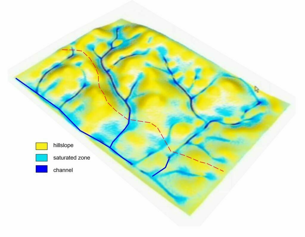
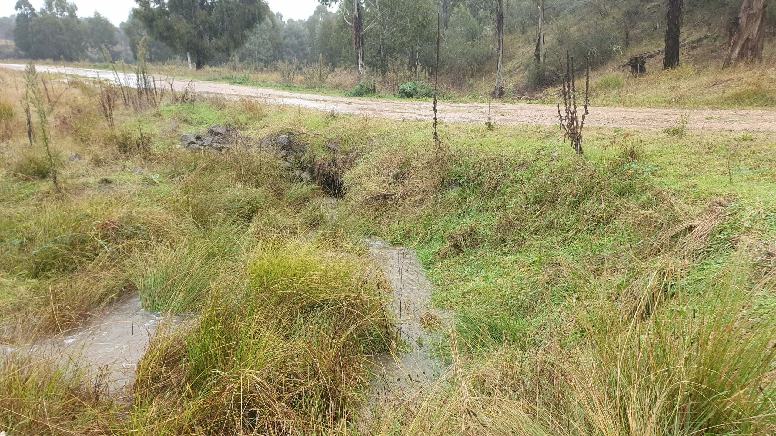
This comes down to hydrology. After rainfall soaks in to a hillslope and wets up the soil, excess water will drain downslope. Lower down, on footslopes and depressions, soils tend to get saturated and excess water forms surface runoff. We are familiar with these areas because they frequently get boggy after rain and remain wet for extended periods. Further down the catchment, as runoff volume increases, channels form, initially as discontinuous features, then becoming more continuous features of a catchment. These situations are illustrated on the diagram below, and you can see wherever the track intersects either ground that is prone to extended periods of saturation, and where channels are present, a crossing is likely to be required.
Types of crossings
Pipe culvert
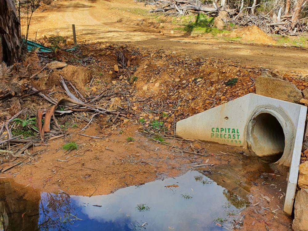
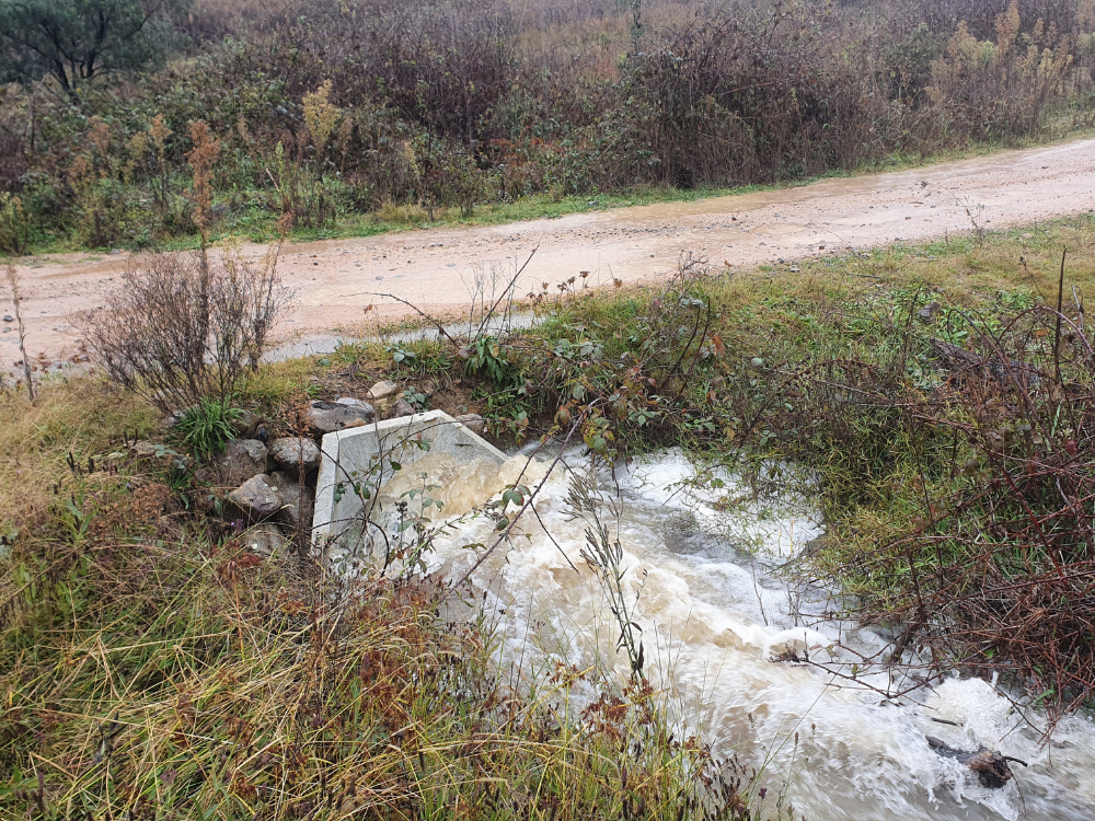
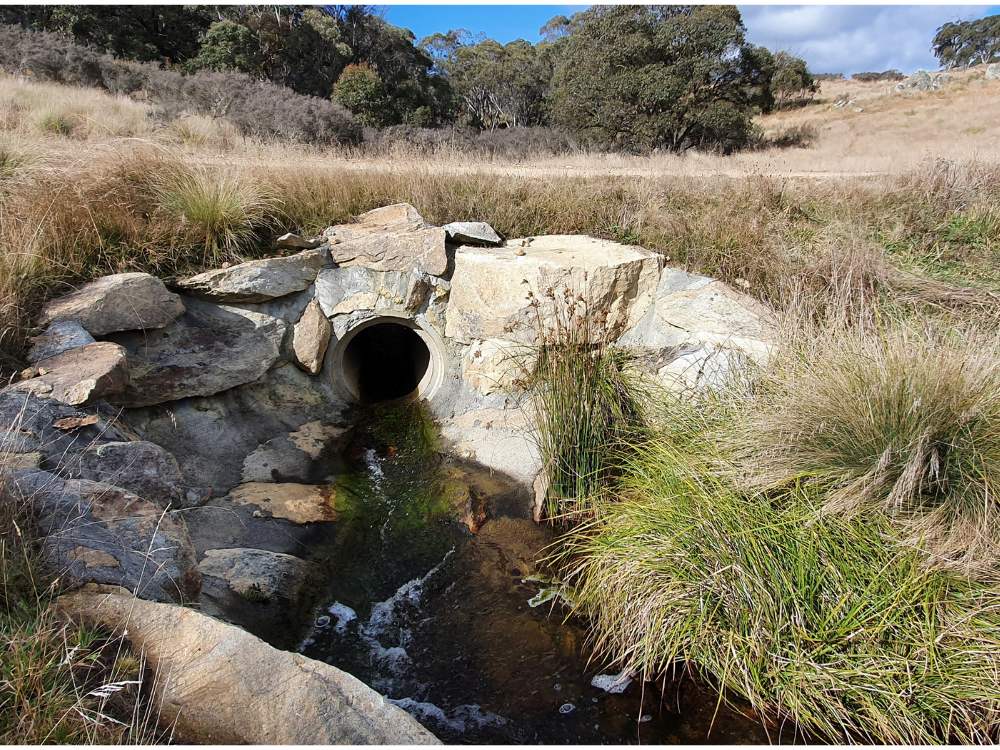
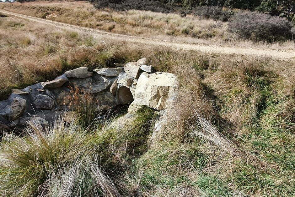
A pipe culvert allows the track surface to be elevated over a watercourse or boggy area. The pipe, between 0.3 and 1.0m in diameter, carries the water, and is supported by headwalls which hold the fill material of the track in place. Additional rock or grass holds the fill in place beyond the headwalls. Pipe culverts are only suited to smaller, non perennial watercourses and boggy areas. They are relatively cheap to construct, but are often done poorly. Typical problems include lack of headwalls, undersized pipes and poorly stabilised fill. Over time, they often get clogged with sediment leading to blowouts and track damage.
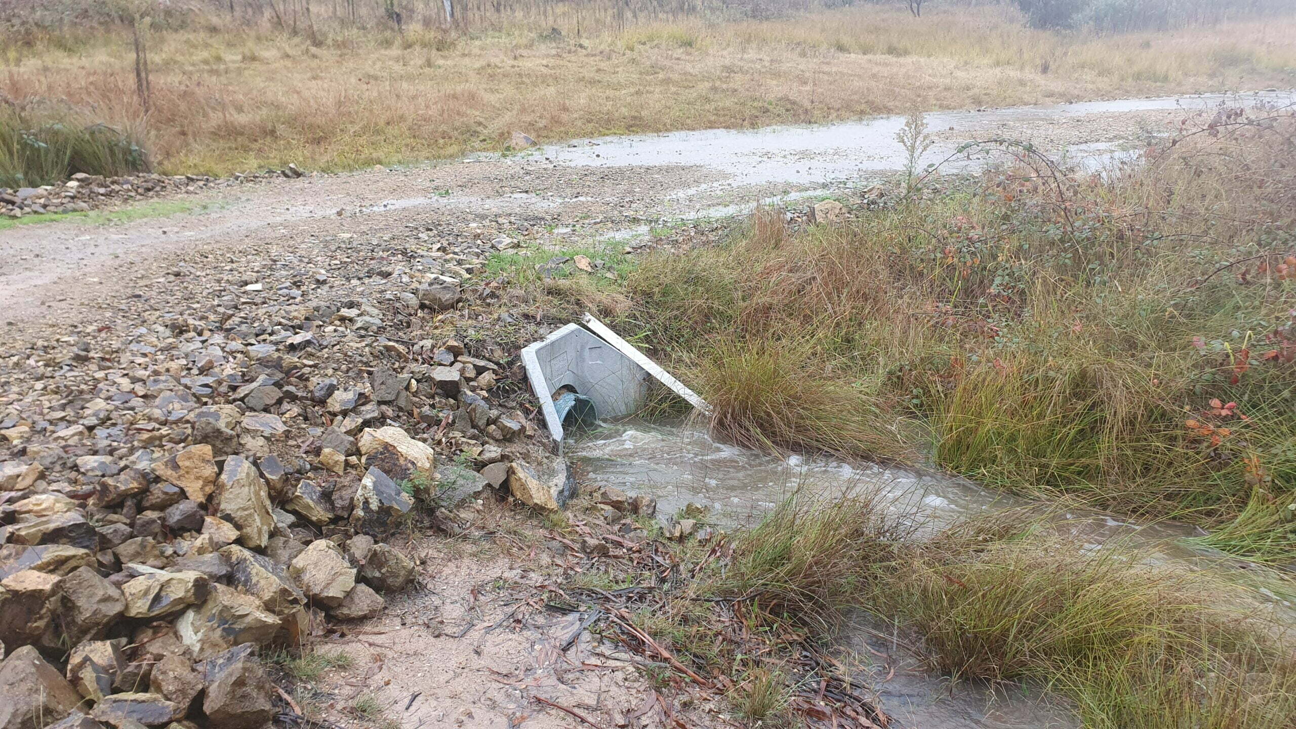
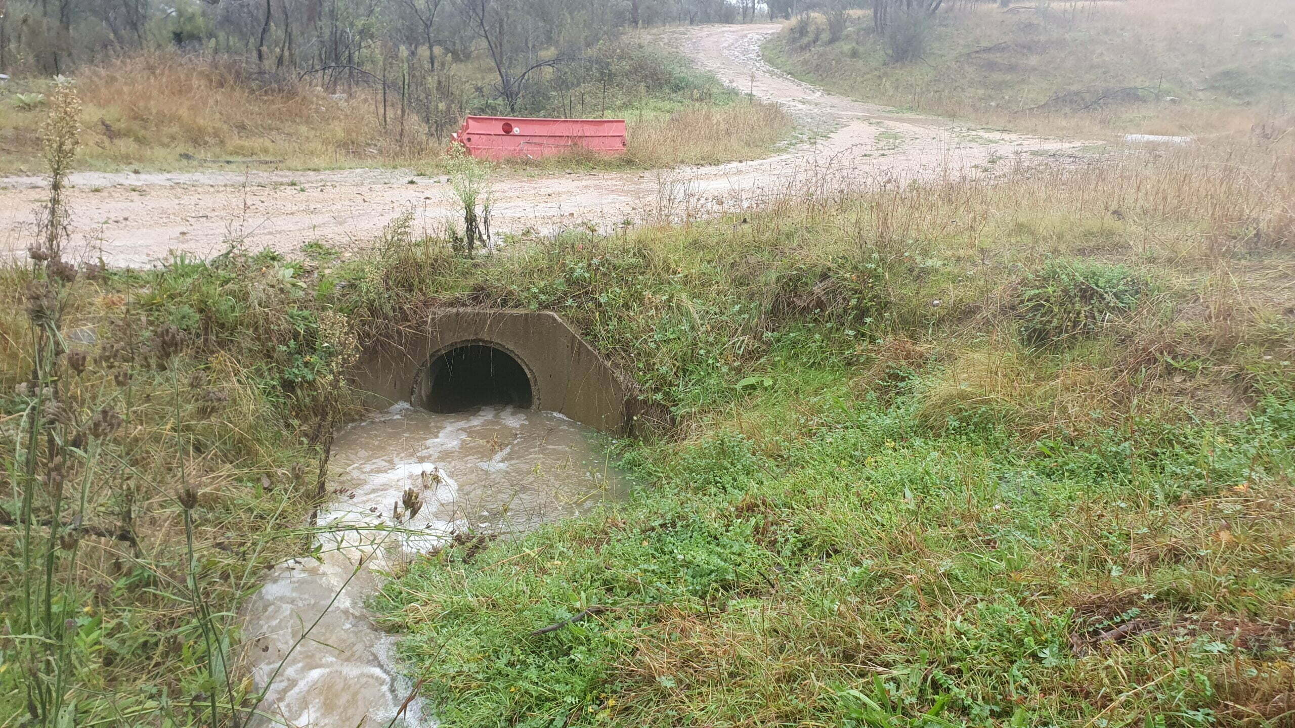
Box Culverts
Box culverts are typically used on larger watercourses, with deep, well defined channels carrying perennial flows and significant flood volumes. They have a rectangular cross section and hence larger cross section than a pipe with equivalent diameter, and require less fill to build up the track surface. As with pipe culverts, additional rock stabilisation is required for fill on the track approaches. Box culverts are suited to fish passage however design standards now require adequate spans to minimise alteration of the flow regime.
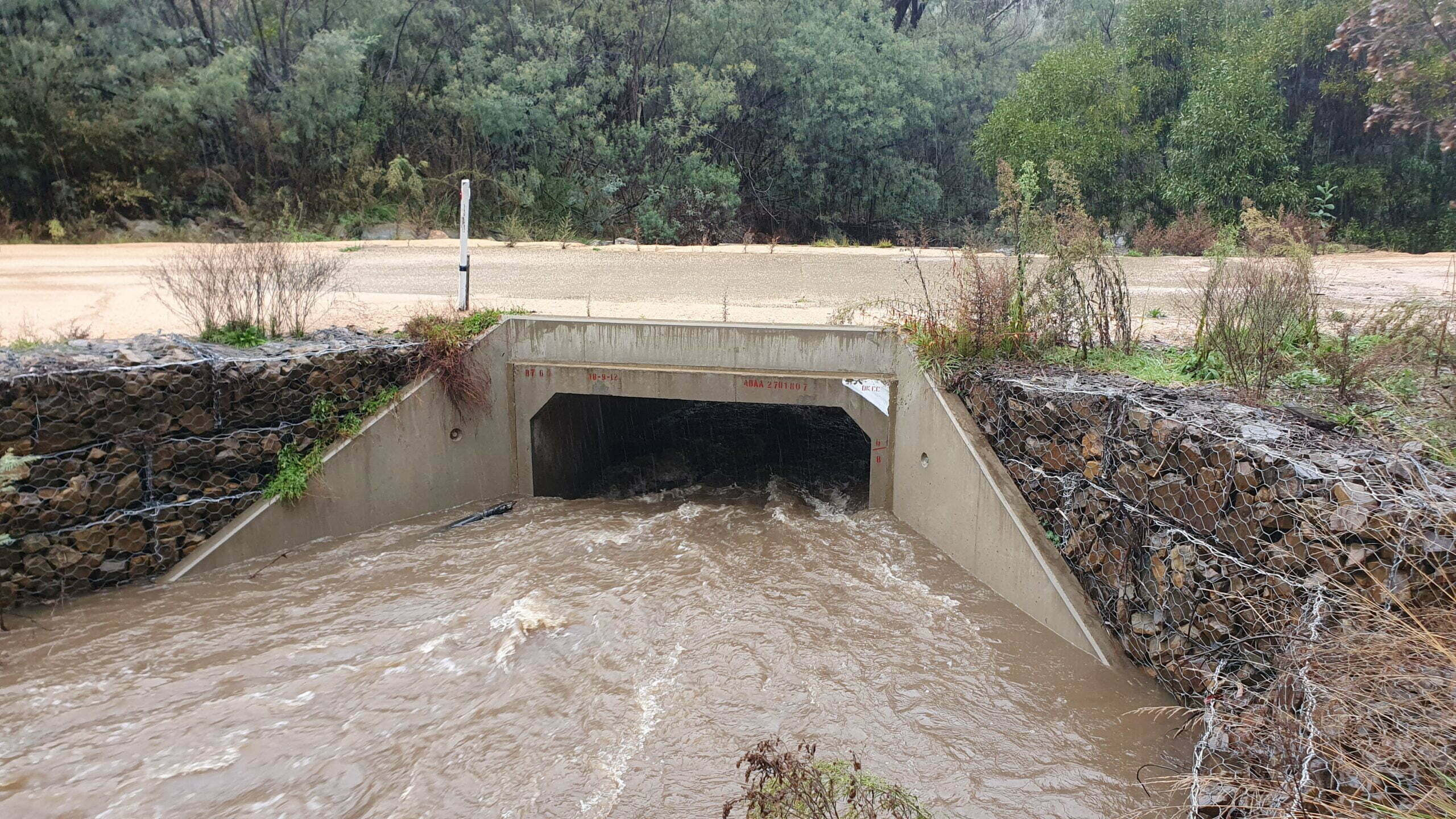
Natural crossings
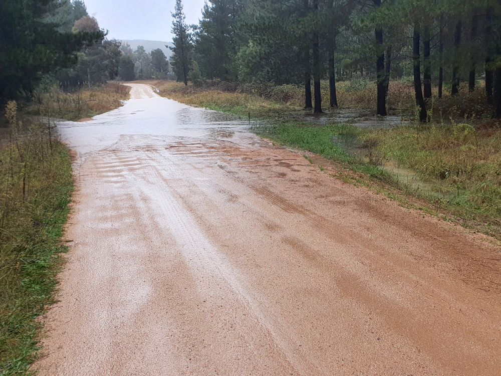
Occasionally, natural conditions allow a watercourse to be crossed with minimal intervention. Typically a natural crossing has a firm stony bed and low or no channel banks. While natural crossings will be prone to closure in periods of high flow, they may well be suitable for intermittently used tracks. The key consideration is the control of track runoff to ensure sediment delivery to the watercourse is minimised. This is discussed later in this guide.
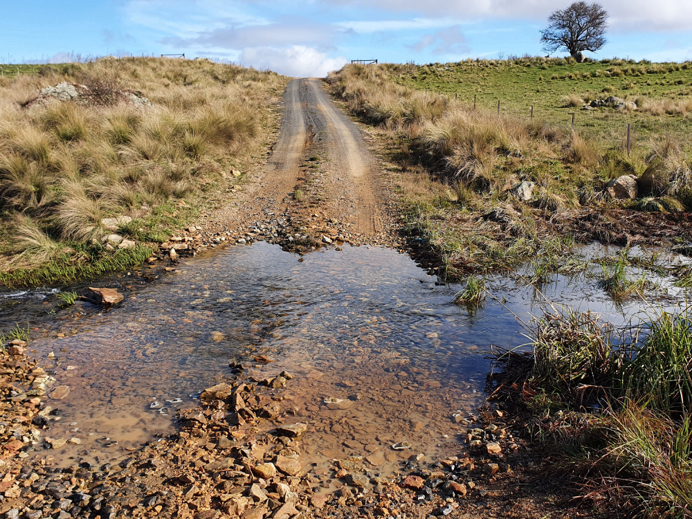
Bed level crossings
A bed level crossing permits water to flow unobstructed along the channel, and thus interferes in only a minimal way with aquatic and riparian ecology. The crossing is graded so there is no overfall on the low side, as tends to occur with concrete fords. The crossing is anchored with large angular rock installed in a trench cut across the channel, then built up with smaller rock anchored between the larger rock. The final finish is a relatively smooth but resistant rock surface suitable for driving and also for transmitting water flows unobstructed. Bed level crossings are considered best practice for many situations. Their higher upfront cost is balanced by the need for minimal ongoing maintenance.

Planning your crossing
In order to establish the best solution for your crossing site, you need to understand your site, in terms of biological and physical characteristics. You should check at least 100m upstream and downstream. The following characteristics are a guide.
Biological characteristics:
- Perennial or intermittent flows; whether the channel dries up or has permanent pools
- Presence and extent of riparian zone
- Growth forms and plant composition of riparian zone
- Aquatic (in-channel) vegetation and growth forms
- Potential for fish movement
Physical characteristics:
- Channel flows or diffuse saturation
- Flow magnitude/discharge volume
- Soil types: prone to dispersion or stable
- Nature of channel, rocky bed or fine sediment
- Approaches, whether prone to saturation or well drained; steep or gentle
- Opportunities to divert road runoff
- Stream order
Regulations
You must also check with your government agencies responsible for water management and fisheries management to see if you need to make application to construct a new crossing or ameliorate an existing crossing. Aboriginal heritage may also be a concern, so check the Aboriginal Heritage Information Management System (AHIMS) in NSW or its equivalent elsewhere. Local government may also need to give consent to crossing works. So the message is very much dial before you dig.
- Policy and Guidelines for Fish Friendly Waterway Crossings (NSW DPI – PDF)
- Guidelines for watercourse crossings on waterfront land (NSW DPI – PDF)

Construction: Best practice crossing solutions
Pipe culverts
Pipe culverts may be the best solution for small crossings on boggy areas or minor, non perennial channels. The following construction considerations should be followed:
- Construct only when dry
- Minimise disturbance to within footprint of crossing
- Determine location of stockpiles for topsoil, fill, construction materials
- Crossing should be perpendicular to flow
- Inlet and outlet at bed grade to minimise risk of scour
- Larger pipe diameter less likely to block up.
- Headwalls crucial to hold fill in place and protect from scour around pipe
- Fill not held by headwall should be held in place by rock or topsoiled and grassed
- Approaches must be stable and minimise risk of sediment entering stream (see later)
Bed level crossings
- Suited to most situations, from boggy ground to larger perennial watercourses on catchments up to 500ha
- Running surface is at bed level so suited to maintaining aquatic ecology function including fish passage
- Will withstand flood flows, not at risk of blowing out
- No fill so minimal risk of sediment washing into watercourse
- Includes rock reinforced approaches in and out of crossing to control erosion of banks
- Construction only by an experienced conservation earthworks contractor, for instance NSW Soil Conservation Service has extensive experience in this area


Step 1: Crossing site is excavated to between 0.5 and 1.5m, depending on catchment size and design size of rock; vertical sides important to secure rock in place.

Step 2: Heavy duty geotextile is laid on the floor of the excavation to minimize the risk of rock sinking into bed.

Step 3: Largest diameter rock is placed on floor of crossing and tamped down with excavator bucket.

Step 4: Floor of crossing and immediate approaches covered with large diameter rock.

Step 5: Surface of crossing is finished with smaller diameter rock (50-50mm) and tamped down with bucket to give smooth surface.
Watch this video to learn how to build a bed level crossing.
Track drainage to minimise erosion
The most significant ongoing risk at crossings is sediment washing from the track surface into the watercourse. Good track drainage will minimise this risk. Drainage can be achieved with a diversion bank or mitre drains directing water in the table drain out onto the adjacent hillslope. This should be done at a distance of between 5 and 30m from the top of the edge of the watercourse in order to allow the sediment laden water to disperse and infiltrate on the hillslope. If this cannot be achieved due to the lie of the land, the track should be gravelled on the approaches to the crossing to create a non erosive surface.

Where to get more help
- NSW RFS Fire Trail Manual
- Contact NSW Soil Conservation Service if they have a nearby office.
Waterway crossings webinar
Watch Peter’s webinar on designing and creating waterway crossings on rural blocks and farms from June 2022. The webinar features lots of photos and references online guides to help you recognise the do’s and don’ts of waterway crossings.
