On a beautiful morning with a big blue sky, I drove out from my home in Canberra to the Bumbalong Valley, just near Breadbo on the New South Wales Southern Tablelands, for a pasture and river health field day. Rivers of Carbon co-hosted the event with South East Local Land Services and the Cooma-Monaro Shire Council, to provide landholders with a workshop focusing on the connections between pastures, floodplain paddocks, and riparian management. By looking at the land and river connections the way landholders with river frontages do, we brought together some easy to use checklists and information to help them manage these parts of their properties.
We started with Jo Powells taking us through a few different paddocks as we walked down the slope to get to the river. Jo showed how paddocks vary enormously in soil type and the pastures they can support, with this depending on a range of factors including micro-biology, nitrogen fixing capacity and weed load. We used a Visual Pasture Health Assessment checklist to assess what we were looking at ‘down at the dirt’ of our pastures. It is a really simple, but effective tool, and we have provided a link to it here so you can download it and use it too. Our group enjoyed poking the soil with our fingers to assess hardness, friability and a whole range of other parameters (poking just measured one of these!).

Image A
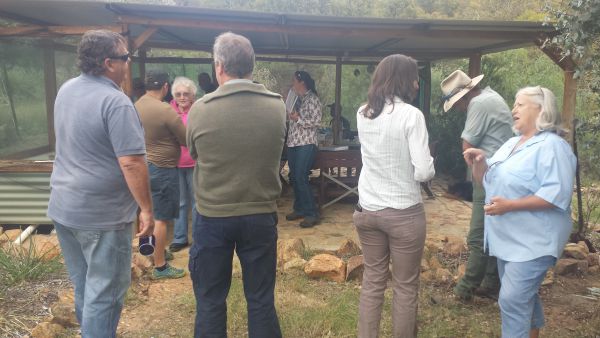
Image B
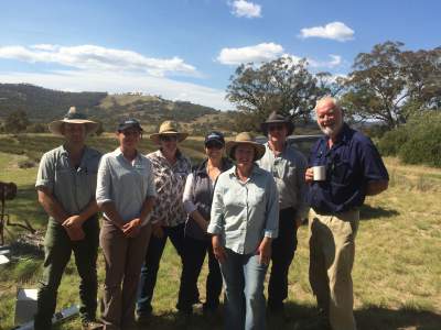
Image C
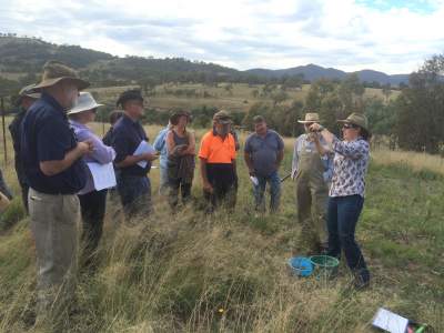
Image D
As we moved down the hillslope the quality of the soils improved, with more moisture apparent and a more diverse pasture with fewer weeds. We talked about the need for floodplain paddocks to be carefully managed so that soil stays in the paddock and not washed off into the river. This can be achieved by keeping at least 80% cover on the paddock and moving stock through a rotational grazing system to ensure that this cover is maintained. Managing weeds like African Lovegrass, willows and blackberries was also discussed, with Warren and Neil our ‘go to’ advisors on this often fraught topic.
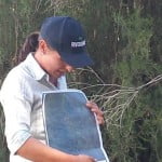
Image E
Our final stop was on the banks of the Murrumbidgee where we sat under the shade of the vegetation protected and planted by Kim and Helen, our generous landowners. It was at least six degrees cooler at the riverbank, and we welcomed that shade – this is exactly why riparian corridors are so important, as they provide plants and animals with ‘thermal refuge’ from the negative impacts of climate change.
Antia talked about the great work that has been undertaken along the Bumbalong Valley, with maps showing the connections between properties owned by landowners working with us to control blackberry and willow, and who are then moving on to revegetate, or further extend plantings in their riparian areas.
At this point in our morning we swopped pasture checklist, for stream condition checklist. Our stream condition checklist has proved to be extremely popular, with the last of our current stock of copies distributed at the field day (don’t worry we are ordering more!). Antia talked about how the ‘good’, ‘moderate’ and ‘poor’ ratings in the checklist are linked to photographs showing what that condition looks like. The use of photographs makes it much easier for people to visualise what these ratings actually mean, as well as making the checklist much easier to use when they are on their own with no Antia around to help them.
We had some great questions from our group, including some concerns about the difficulties created when a few landowners don’t get involved in projects like willow and blackberry removal along a river reach. This makes it harder on those that try to manage these invasive species, as those unmanaged areas can be a source of re-infestation. There is no easy answer or solution to this problem, except to acknowledge it is a something all river reaches across Australia experience. For those at the field day we resolved that although it felt unfair and sometimes disheartening, the positive outcomes of getting rid of weeds and bringing the riparian zone back to life through revegetation and connectivity, far outweighed the frustrations.
Overall, it was a great field day and I felt privileged to be a part of it. I also made some new friends who I plan to keep in touch with. Siwan 🙂
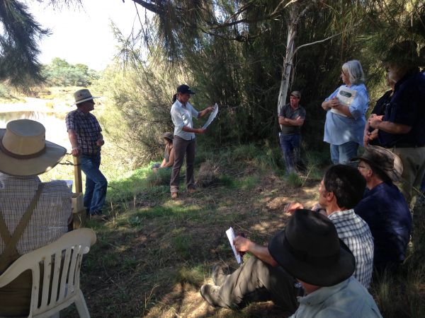
Image F
A range of organisations contributed to this event with the New South Wales Environmental Trust a key funding partner, and Bush Heritage Australia also a valued partner and ‘Scottsdale’ property owner in the Bumbalong Valley. This project is part of our Rivers of Carbon Upper Bidgee initiative.
Image A: Catching up with landholders and providing them with the latest products
Image B: Introduction to the Field Day and getting to know each other
Image C: A happy group of Warren (weeds office Cooma-Monaro Shire), Antia (RoC), Jo (SeLLS), Siwan (RoC), Helen (generous landowner), Neil (Cooma-Monaro Shire) and Kim ( generous landowner)
Image D: Jo washing off the soil so we can look for nitrogen nodules on the roots of the plant
Image E: Antia showing how much as been achieved by landowners working together in the Bumbalong Valley
Image F: In the shade of the riparian zone, talking about stream condition and how to manage these special parts of the property